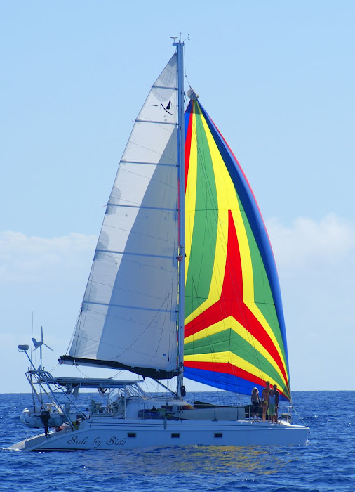
Since October, we sailed north to Annapolis for the boat show and a wonderful reunion with several dear friends. A side trip to Saratoga left us leaving Annapolis much later than planned. With kids, the issue was "where to be for Halloween". We tried to make it all the way to NC but decided to enjoy the Dismal Swamp instead. Halloween was spent in Elizabeth City, NC with 11 other kids (pictures on facebook.) After stopping in Orcacoke NC we arrived in Carolina Beach NC a week after Halloween to see our friends on Aly Cat, Lew, Alyson and Caroline. Every day, Alyson took us on various errands to stock up on non perishable food and boat supplies we many need for the next year. An hour before they left, we did a fresh food run to load up the fridge and Lew and Marc did a guy trip to buy engine products and booze.. but no ink cartridges. After a wonderful 5 days with Aly Cat in Fayetteville NC where we enjoyed unlimted hot water, a washer/dryer, internet, roller skating, dining out and of course their unending hospitality, we cut the dock lines on Monday to head to St. Thomas, V.I. Most boats are heading south this time of year and there are several ways to make your way to warmer weather. The cruisers inter coastal waterway (ICW) starts in Norfolk and goes to Florida following rivers and canals inside of the ocean. Many families with kids elect the "inside route" as there are not issues with big seas. Marc and I find the ICW more stressful and would rather make a few big overnight passages then them to worry about bridge schedules, being rocked by the boat wake of big power boats, finding anchorages for the night and having to be at the helm at all times. From Florida, crossing the Gulf Stream becomes the biggest issue. Some boats do a combination of inside and outside routes, and enjoy stops at popular ports such as Charleston, SC and Cumberland Island Georgia.
The crazy Johnson's and at least 3 other boats are trying to get as far south as possible in one trip. The other boats, however left 2 days before us and are a good 300 miles further east. From Cape Fear NC, our route was over 1100 NM to St. Thomas VI. In order to get south, we wanted north wind. However, a strong north wind against a strong north setting gulf stream can create dangerous standing waves. . The rule of thumb is to not cross the gulf stream when the wind has any north component to it. We diligently studied the latest color analysis of where and how strong the gulf stream would be and picked the weakest point to cross it. Marc and I bantered around our options.. my issue being 25 knots of NE wind predicted when we hit the gulf stream. Marc saying that with only 1.5 knots off the NC coast, the waves would not be a problem and we needed to get east as soon as possible. In the end, we were both right The gulf stream rose to 3 knots and we had a very rough, uncomfortable time crossing it for about 10 hours. After months at the dock, all of us needed to get used to the motion and any activity inside the boat led to nausea. Water was leaking in the front hatches and we had to adjust course to take the waves off the back of the boat more. Prior to hitting the gulf stream, we got to experience the frying pan shoals off of Cape Fear. Now we all understand how they got their name.
Chris Parker, the weather guy boats "sponsor" to help with weather prediction, speaks to the other VI bound boats about easting every day. As the trade winds and waves come from the east, unless you are a freighter it is very difficult to get east in a sail boat. Our original plan was to go to Bermuda but IDA and the corresponding wind and seas made that impossible. The "easting" issue is why we want to get all the way to St. Thomas now, then work our way back north and west with the wind. The wind is supposed to go away along with the seas and we may have 3 days of motoring to get the 480 further east we need to be inline with St Thomas. Hopefully the fuel and engines hold out. Instead, we may end up in Puerto Rico, DR, Turks in Caicos or Bahamas. Imagine a car trip dependent on weather as to where you end up.
Our position is updated daily with the link to the right if you would like to see our progress. More to follow...
